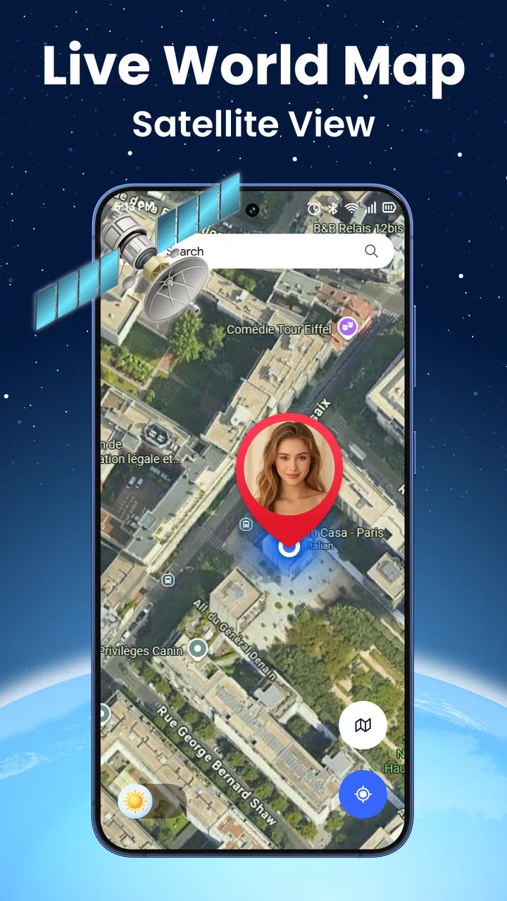
Live World Map: Satellite View
- 3.0
- Rating
- 1.00M
- Installs
- Free
- Price

 Analysis by App-foxy
I opened Live World Map: Satellite View expecting a straightforward way to look around the planet, and that is mostly what it offers: a map-focused app built around live GPS, satellite imagery, and street navigation. The first impression is easy to understand. You can use it to see where you are, switch to an aerial perspective, and explore places that are difficult to appreciate on a conventional road map. That combination gives it immediate appeal, especially when you are curious about an unfamiliar neighborhood or planning a trip.
What matters more to me, though, is whether a map app remains useful after the initial novelty disappears. Satellite imagery is fun to browse for a few minutes, but recurring value comes from how quickly the app helps with a real decision: finding a route, orienting yourself, checking the shape of an area, or getting a better sense of what lies around a destination. In my experience, this app is most convincing when used as a visual companion to navigation rather than as the only tool I would trust for every journey.
From visual curiosity to a practical navigation habit
I find that the app’s visual appeal can be more than a novelty when I use it to build a mental picture of an unfamiliar place before setting out. In this section, I look at how readable the map views feel and how I would choose between them for different navigation tasks. That leads naturally to a closer look at the practical demands of using a map on a small screen.
You May Also Like

 Blood Strike: 2.5 Anniversary
Blood Strike’s Loadouts Turn Every Drop Into a Tactical Gamble
A close look at Blood Strike’s custom loadouts: how fast access to signature weapons reshapes its battle royale rhythm, rewards preparation, and narrows the gap between fights.

 Pandora - Music & Podcasts
Pandora’s Music Is Easy to Start, but Harder to Recover
Pandora’s strength is its low-effort path from a seed to a station. Its weak spot is how much confidence it asks you to place in connection, setup, and quiet recovery.

 8 Ball Pool
 Is Built on Rivalries, Rematches, and Routine
A close look at the rivalries, rematches, shared routines, and unanswered safety questions that turn a quick pool match into a persistent mobile community.

 Samsung Music
’s Quiet Strength Is Playing What You Already Own
Its reach comes less from spectacle than from dependable access to a personal library. That simplicity is both the app’s strongest retention engine and its ceiling.

 AccuWeather: Weather Radar
AccuWeather Review: A Quick, Clear Forecast for Everyday Decisions
For everyday plans, the best forecast is the one you can understand quickly. AccuWeather makes rain timing, radar, and local conditions easy to act on, with a few trade-offs.

 Hill Climb Racing
Why Hill Climb Racing Still Turns Crashes Into One More Run
A tiny car, a bumpy hill and one more upgrade: Hill Climb Racing keeps resurfacing because its simple chaos makes every near-miss feel personal.
More From Our News Desk



Why the first week feels engaging
The strongest part of the early experience is the change in perspective. Standard maps are excellent for roads and labels, while satellite view adds physical context. A bend in a road, a large open area, a cluster of buildings, or the position of a parking lot can make more sense from above than from lines and symbols. That makes the app enjoyable even when I am not actively traveling.
The live GPS element gives the exploration a practical anchor. Instead of searching randomly, I can begin from my current position and move outward. This is useful when I am walking through an unfamiliar district, visiting a large outdoor location, or trying to understand how a destination fits into the surrounding streets. It also makes the app feel less like a static globe and more like a tool connected to the place where I actually am.
During the first few days, I found myself using the satellite layer for small questions that ordinary navigation sometimes leaves unresolved. Is the entrance likely to face the main road? Does a path seem to run behind the buildings? Is a destination surrounded by open land or dense streets? These are not replacements for clear directions, but they can reduce uncertainty before I set off.
Street navigation is the feature that determines whether the app can become part of a routine. A visual map can attract attention, but navigation has to save time. When I am preparing to leave, I want to locate the destination, understand the route, and avoid unnecessary switching between different map tools. The app is at its best when the satellite perspective answers a question that the route view alone does not.
The app is free to install, which makes trying it uncomplicated. It is rated for Everyone, so its presentation is suitable for a broad audience rather than being aimed at a specialist group. Avn Global Application is the developer behind it, and the app has passed one million installs, giving it a substantial audience for a relatively focused mapping tool. Its average rating sits at 3.5 from around one thousand three hundred ratings, so I would approach it with realistic expectations rather than assuming it will replace every established navigation service.
A realistic everyday scenario
Imagine I am visiting a new town for the day and need to reach a café near a park. The road route tells me how to get there, but the satellite view helps me recognize the block before I arrive. I can look at the relationship between the park, nearby streets, and the likely entrance area. Once I am close, GPS gives me a live reference point, while the street view helps me follow the final approach.
That workflow is more useful than simply zooming around the world. I would first search or locate the destination, check the surrounding layout from above, then switch back to the clearest navigation view for movement. The practical tip is to treat satellite imagery as a preparation and orientation layer, not as the view to stare at while walking. Aerial imagery can be visually rich but less immediately readable when I need a quick turn.
What makes the app different from ordinary map alternatives
Most familiar navigation apps are built around getting from one point to another with minimal distraction. Their main strength is route clarity, traffic context, saved places, transit information, or a mature ecosystem of local listings. Live World Map: Satellite View takes a more visual approach. Its appeal is the ability to combine location awareness with a broad, map-centered look at the world.
That difference matters depending on the task. If I need a dependable daily commute, a highly established navigation platform may be the better choice because habit, search depth, and transport information can matter more than aerial exploration. If I want to understand the physical layout of a place or enjoy browsing locations from above, this app has a clearer reason to exist.
I would not judge it only by whether it duplicates the largest navigation services. A smaller app can still earn a place if it handles one particular job more comfortably. Here, that job is visual orientation: using GPS and satellite imagery together to make unfamiliar surroundings easier to picture.
Questions that arise after the novelty
One question I had early on was whether the app is useful without constant exploration. The answer depends on how often I encounter places I do not know. Travelers, walkers, students, property viewers, and people who regularly visit large venues may return to it because the aerial layer answers practical questions. Someone who only drives familiar routes may open it once, enjoy the view, and then forget it.
Another question is whether it should be used as a primary navigation replacement. My answer is no, not automatically. I would compare the route information with the navigation tool I already trust before relying on it for an important appointment, a complicated trip, or a journey where a wrong turn would be costly. The app is valuable as an additional perspective, but that is not the same as being the strongest all-purpose navigation system for everyone.
Small habits that improve the experience
I get more from the app when I decide what I am trying to learn before zooming in. For example, I might inspect the approach to a destination, identify nearby open spaces, or understand whether the road network is dense or spread out. This prevents the satellite layer from becoming an endless scrolling exercise.
I also prefer checking an area at two scales. A wider view explains how the destination fits into the neighborhood, while a closer view reveals the immediate surroundings. Looking only at a close-up can hide the best approach; looking only from far away can make the destination difficult to identify. This two-step scan is a simple habit, but it turns visual browsing into preparation.
For walking, I would check the route before leaving and then use the live position sparingly. Constantly watching a screen can be distracting, and an aerial view is not always the fastest way to interpret the next turn. For driving, I would prepare before moving and keep attention on the road. The app is most helpful when it reduces uncertainty before the journey rather than demanding continuous interaction during it.
The month-to-month value
After the first month, an app like this needs a repeatable reason to be opened. The recurring value is not simply that the world looks interesting from above. It comes from a set of small, repeatable tasks: checking an unfamiliar destination before visiting, orienting yourself in a new area, comparing a road layout with the surrounding terrain, and using GPS to connect the map with your current position.
That makes it a useful secondary app for people who explore locally. A person who walks different routes every weekend may appreciate having a quick visual reference for parks, side streets, and open areas. Someone who travels occasionally can use it during the planning stage, when understanding the shape of a destination is often more useful than reading a list of nearby places.
The longer-term value is weaker for users whose needs are mostly routine. If I travel between the same home, workplace, and shops, a familiar navigation app is likely to remain faster. I might still keep this one installed for unusual trips, but it would not necessarily become a daily habit. That is not a flaw so much as a clear limit to its audience.
The app’s current version is 14.1.14_20251227, and seeing an actively versioned product is encouraging for maintenance. Still, a version number alone does not determine how smoothly an app fits into a long-term routine. What I care about is whether map viewing, location handling, and navigation remain easy to reach as I return to it. The best maintenance strategy for a user is to keep the app updated through the normal store process and occasionally check that its location behavior still matches personal preferences.
Where recurring friction can appear
The main source of fatigue is the gap between visual appeal and practical speed. Satellite imagery invites exploration, but exploration can become slow when I only need a simple answer. If I open the app to locate a nearby street, I do not want to spend time interpreting a detailed aerial scene when a clean road map would settle the question immediately.
There is also a mental cost to switching viewpoints. Satellite, GPS, and street navigation each communicate information differently. A first-time user may need a moment to understand which view is best for the current task. I found that the app becomes less tiring once I assign each mode a purpose: satellite for context, GPS for position, and street navigation for following a route.
Another consideration is payment. The app is free, but optional in-app purchases range from $1.99 to $14.99 per item. That does not make the free experience unusable, yet it is worth noticing before treating the app as a completely cost-free long-term tool. I would first use the basic experience for several real trips and only then decide whether any paid option adds enough value to justify the expense.
For a map product, reliability is more important than visual polish. A delayed position, unclear route, or confusing transition between views can undermine confidence quickly. I would therefore test it on an ordinary local journey before depending on it in a place where I cannot easily recover from an error. This is especially important for users who expect one app to handle every navigation situation.
Who is likely to keep using it
I think the app earns lasting space on the phone of a visually minded traveler. If I enjoy studying places before visiting them, the satellite perspective adds a layer that a plain route planner does not always provide. It is also a good fit for people who spend time outdoors, visit unfamiliar neighborhoods, or need to form a quick mental picture of a destination.
It may suit families as well, particularly when a child wants to explore cities, coastlines, or landmarks through a map rather than through a conventional travel guide. The Everyone age rating supports that broad accessibility, although I would still guide younger users when location features are involved and explain that map imagery is for orientation, not a guarantee of real-time conditions on the ground.
I would be more cautious recommending it to professional drivers, delivery workers, or anyone whose income depends on highly dependable routing. Those users may need specialized traffic, scheduling, address, or fleet tools. A satellite-focused app can complement such services, but it should not be assumed to replace them.
It is also not the best choice for someone who wants a map with no learning curve beyond typing a destination and following a highlighted line. The app’s distinctive value comes from looking around and combining perspectives. If that sounds like extra work rather than useful context, a conventional navigation service will probably feel more efficient.
How to decide whether it deserves permanent storage
I would make the decision after testing three situations rather than judging it from a single launch: a familiar local route, an unfamiliar destination, and a planning session using satellite imagery. If it helps me understand the unfamiliar place faster, it has a clear role. If it only provides an attractive view but does not improve preparation or orientation, it may be better treated as an occasional curiosity.
The most important trade-off is focus. This app gives me a broad visual experience, but broader is not always better. A specialized navigation alternative may provide more detailed route guidance, while a standard map may be quicker for addresses and nearby businesses. Live World Map: Satellite View becomes worthwhile when its aerial perspective changes how I plan or understand a journey.
My long-term verdict
After the first-week excitement fades, I see this as a useful companion rather than a universal replacement for established map services. Its strongest qualities are the combination of live GPS, satellite exploration, and street navigation, plus the simple pleasure of understanding a place from above. Those features can support real decisions, especially before visiting unfamiliar locations.
Its limitations are equally clear. The visual layer can slow down simple tasks, navigation confidence should be tested before important trips, and optional purchases mean the free label does not tell the whole story of potential long-term use. The app also depends heavily on the user having a reason to explore or orient themselves; routine commuters may not return often.
My recommendation is to install it if you want a map that helps you see the physical character of a place, not merely reach an address. Give it a fair trial on a real outing, use satellite view for preparation, and switch to the clearest route view when moving. If that workflow becomes part of how you plan trips, it has earned a lasting place. If you only need fast, familiar directions, another navigation app will probably serve you better.
My final take: this is a free, accessible mapping app with genuine recurring value for visual exploration and unfamiliar destinations, but its long-term role is specialized. I would keep it installed as a practical second opinion for places I do not know, while relying on a more established alternative when navigation accuracy, speed, or detailed travel information matters most.
FAQs for Live World Map: Satellite View
01What features does Live World Map: Satellite View offer?
Live World Map: Satellite View provides real-time satellite imagery and street-level views of locations worldwide. You can explore landmarks, navigate through cities, and even check traffic conditions. The app also offers weather updates and terrain views, making it a comprehensive tool for travelers, geography enthusiasts, and anyone curious about the world.
02Is Live World Map: Satellite View free to use?
The app offers a free version with basic features, but for advanced functionalities like offline maps, ad-free experience, and higher resolution imagery, there is a premium subscription. The cost of the subscription varies depending on the plan you choose, but it provides great value for those who need extensive use.
03How accurate is the satellite imagery in Live World Map: Satellite View?
The app uses high-quality, up-to-date satellite data to ensure accuracy. However, the frequency of updates can vary by location, with urban areas generally receiving more frequent updates than remote regions. Users should be aware that while highly accurate, there can be minor discrepancies due to the nature of satellite technology.
04Can I use Live World Map: Satellite View offline?
Yes, the app allows users to download maps for offline use, which is especially useful when traveling to areas with limited internet connectivity. However, this feature is part of the premium subscription. Offline maps retain the quality and detail of their online counterparts, ensuring a seamless navigation experience.
05Is Live World Map: Satellite View suitable for navigation?
While the app provides detailed maps and traffic information, it is primarily designed for exploration and educational purposes rather than real-time navigation. For turn-by-turn navigation, users might want to use dedicated navigation apps. However, the app's detailed maps and satellite views can complement other navigation tools effectively.
Pros
- High-resolution satellite imagery.
- Real-time location tracking.
- User-friendly interface design.
- Offline maps availability.
- Multiple map views and layers.
Cons
- Requires stable internet for updates.
- High battery consumption.
- Some features are premium.
- Occasional map loading delays.
- Limited customization options.

Live World Map: Satellite View
Gallery